Field Arts Workshop: Cartography 101 for Field Notebooks

Let’s explore cartography for your nature journals and field sketchbooks. Adding maps is fun and although they can be challenging and even intimidating, they will greatly enhance not only your journals but your understanding of a place.
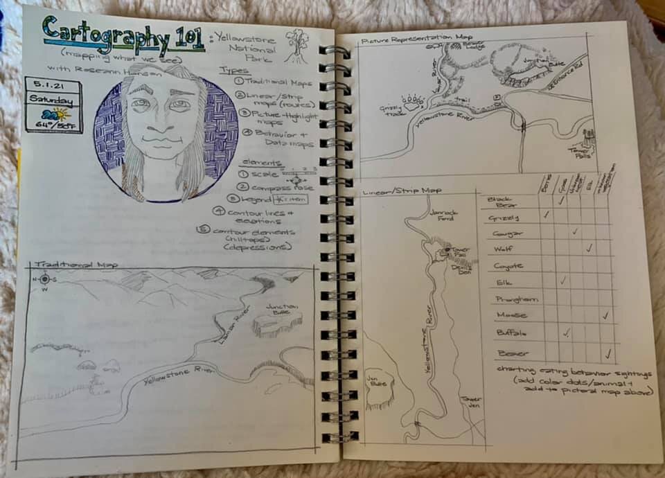
Traditional maps with features such as contours and shading to show relief
Linear maps that unfold or scroll from point-to-point on an exploration of a place or region
Picture-highlight maps of a place, including non-scale ideas for quick mapping
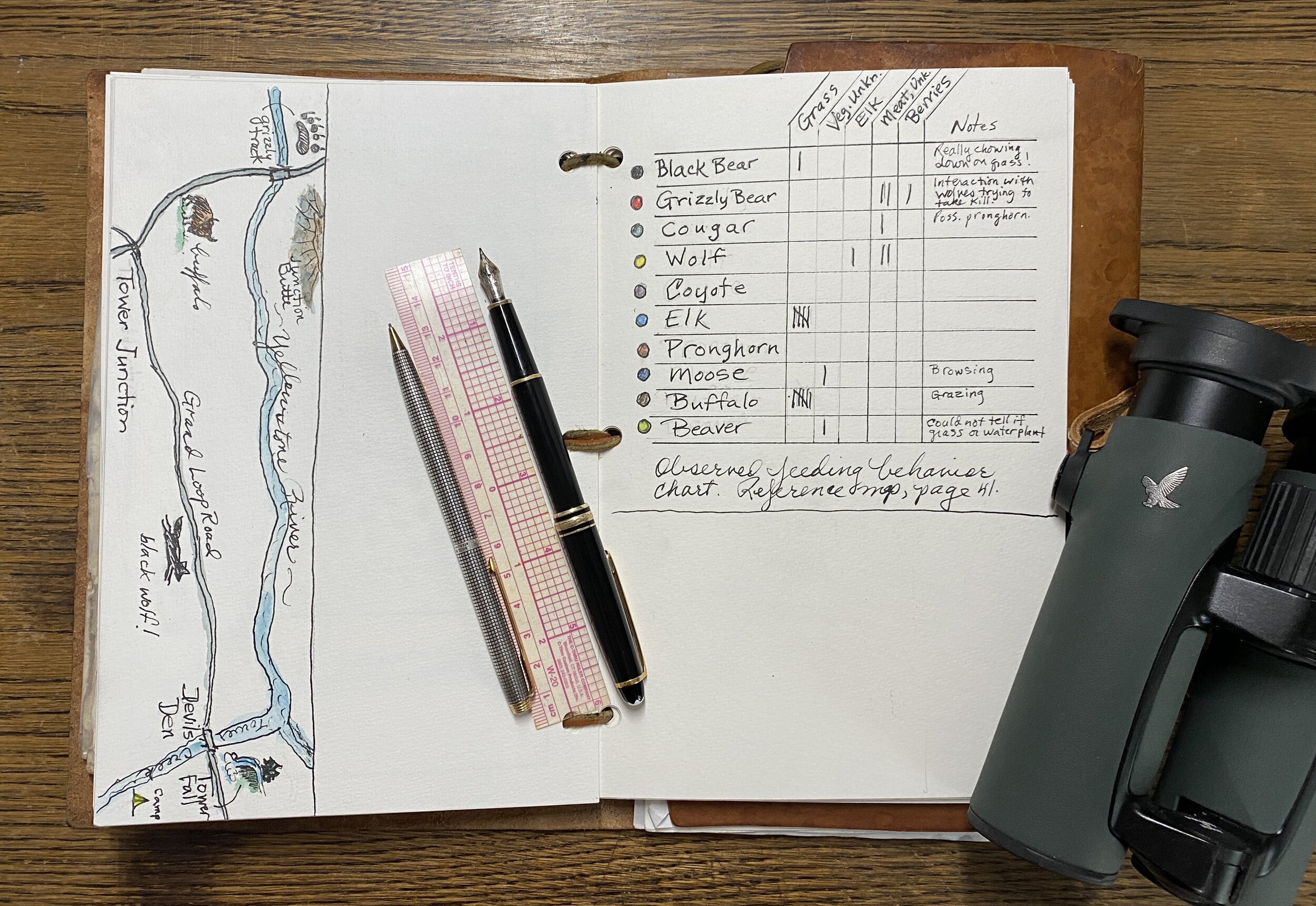
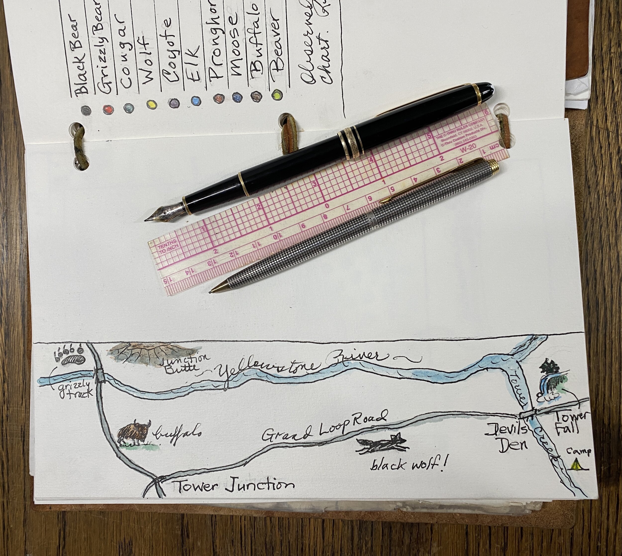
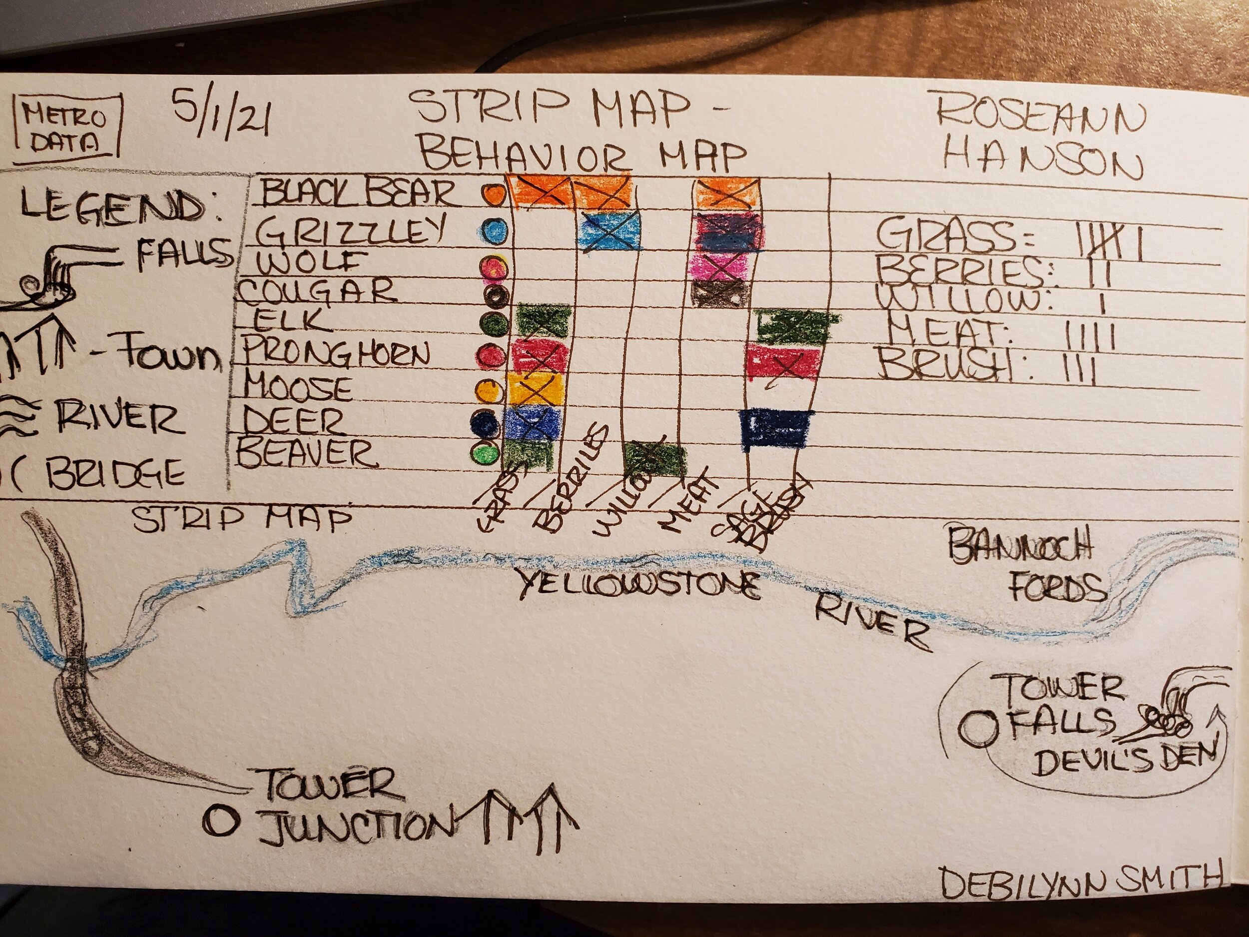
Behavior maps depicting such things as an animal foraging or defending a territory
Length: 2 hours
Resources from the Workshop
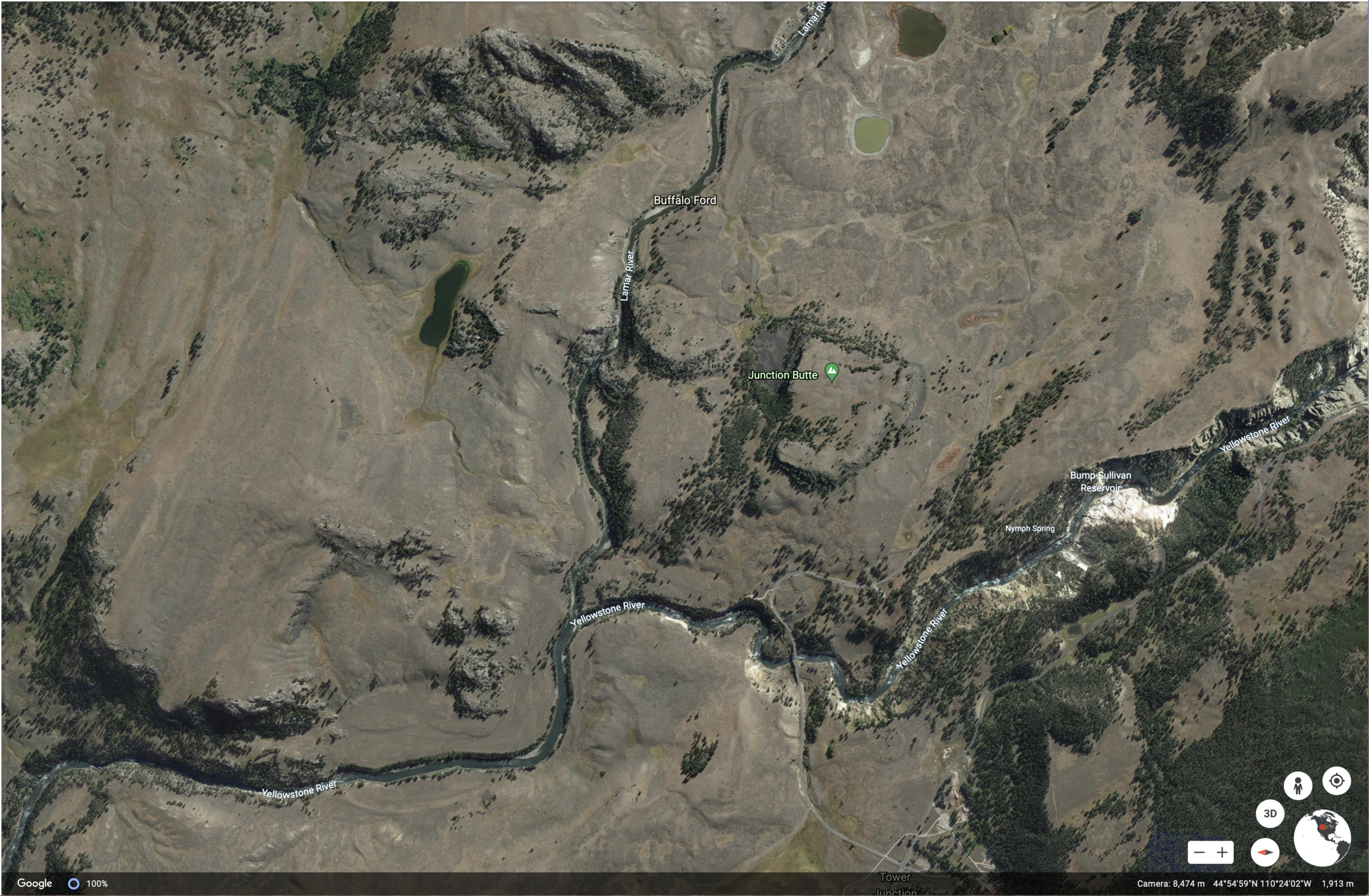
Google Interactive View of the Northern Ranges, Yellowstone:
Downloads (Cartographic Elements and Features):

JPG of cartographic elements and features (printable for your journals):
PDF of cartographic elements and features (larger format):
Video of Yellowstone Northern Ranges:
https://www.nps.gov/media/video/view.htm%3Fid%3D17806168-1DD8-B71B-0BE946127DB84B95
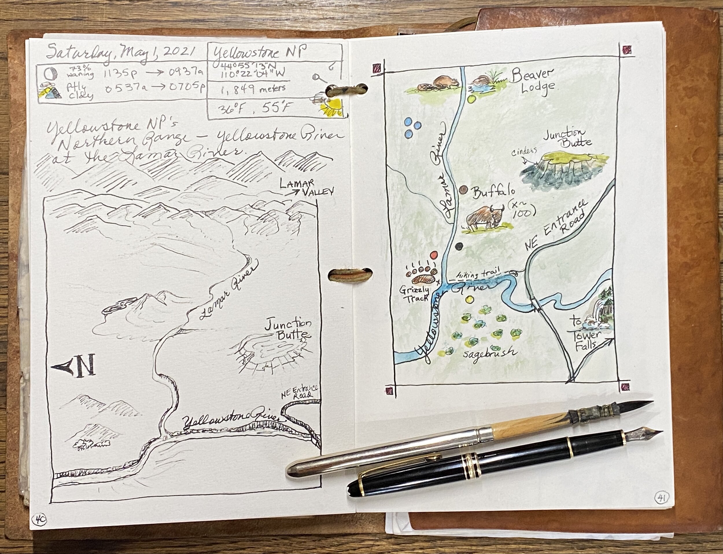
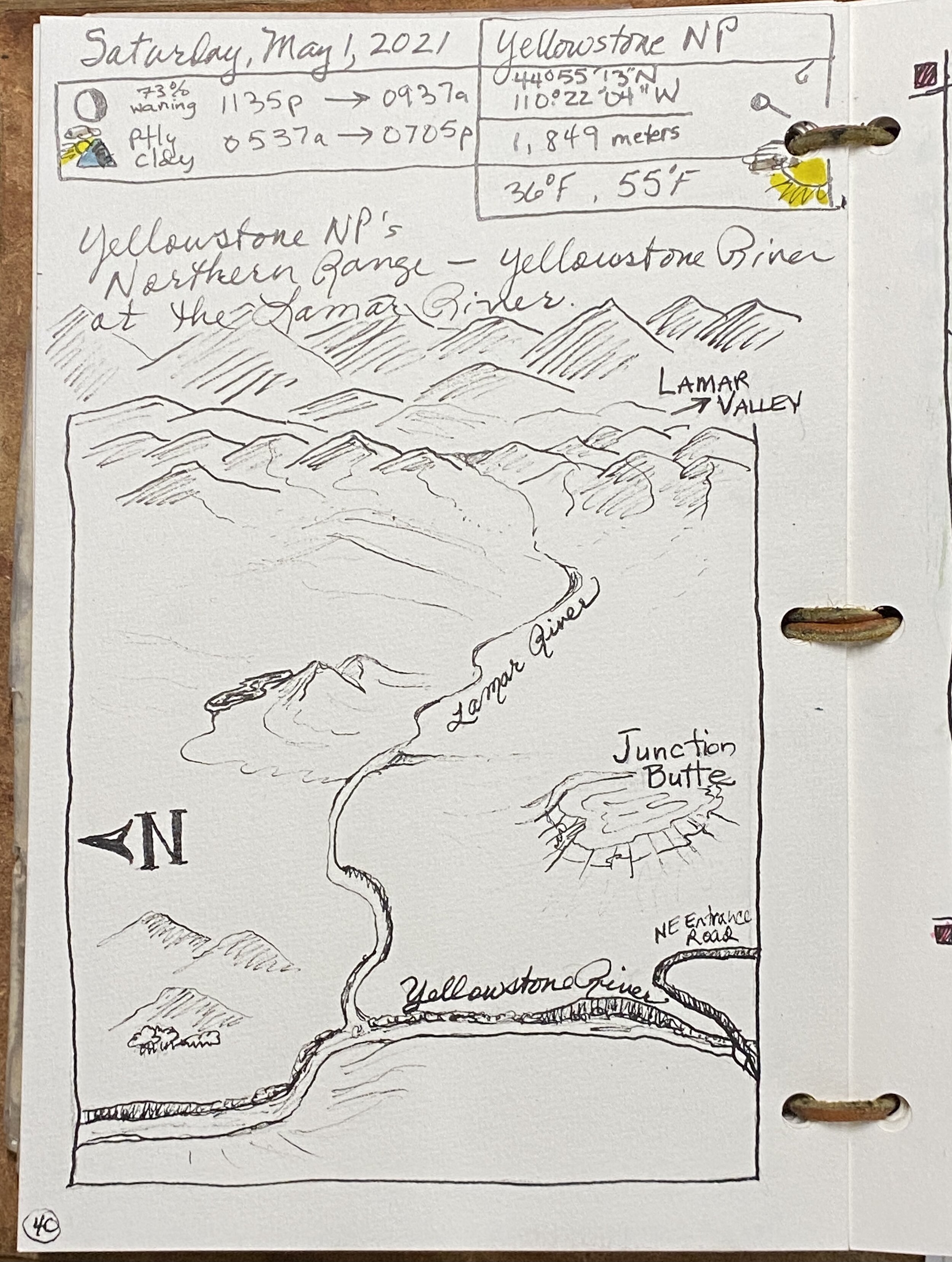
METADATA AND NATURE DATA for MAPPING LOCATION:
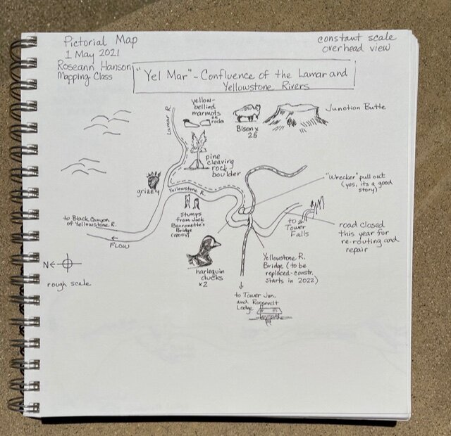
Location: Confluence of Yellowstone River and Lamar River, “Yell-Mar,” in the Northern Ranges
Latitude: 44 degrees 55’ 13” N
Longitude: 110 degrees 22’ 04” W
Elevation: 1849 meters (6066 feet)
Low:36 degrees F
High: 55 degrees F
Sunrise: 1135 am
Sunset: 0937 pm
Moon phase: 73% waning
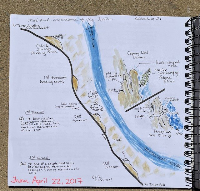
ROSEANN’S FIELD NOTES PAGES from THE WORKSHOP:
You can find my list of minimalist colors and tips on color mixing here: https://www.exploringoverland.com/field-arts-tutorials-list/2020/7/5/minimalist-watercolor-for-nature-journaling
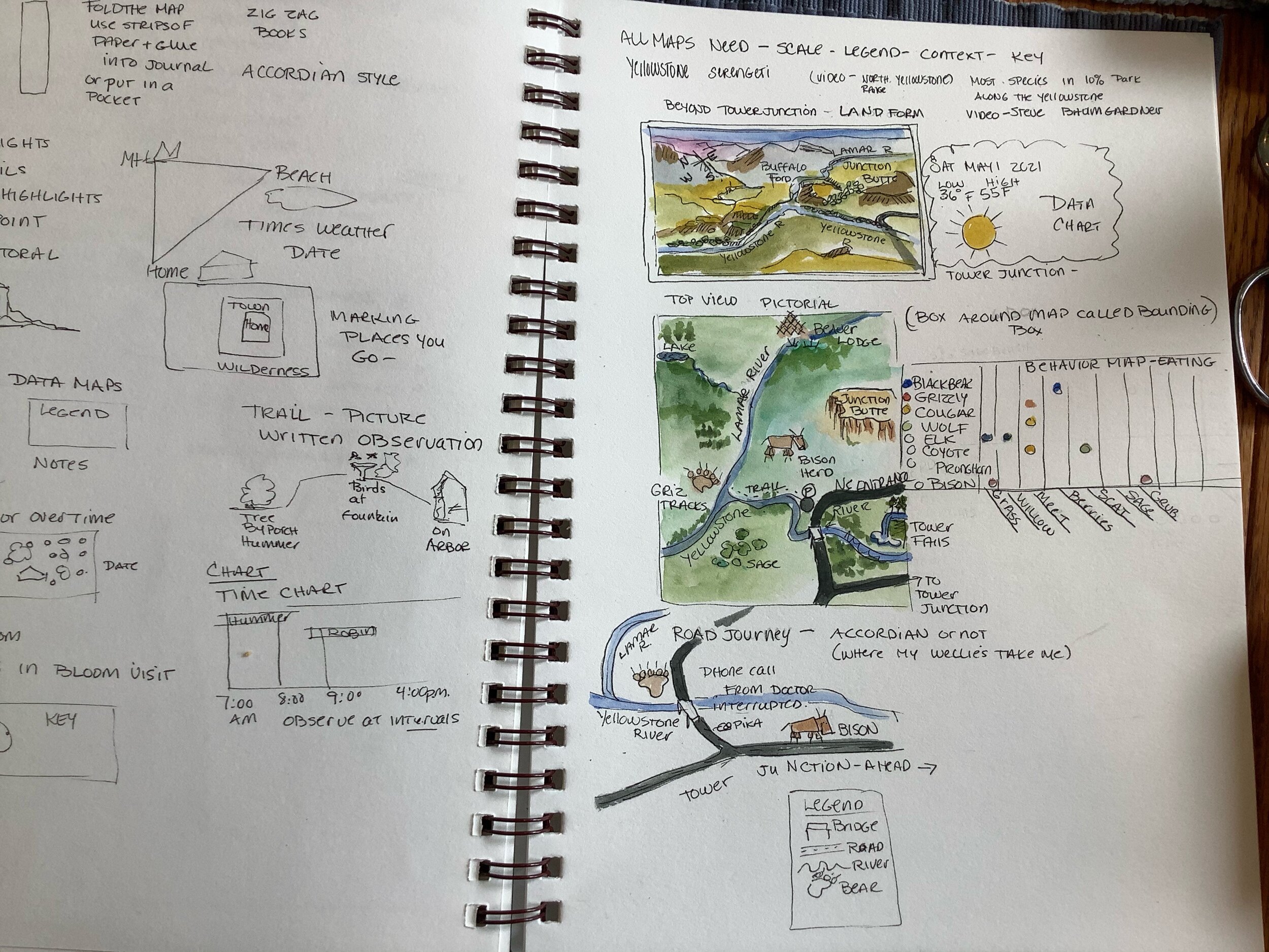
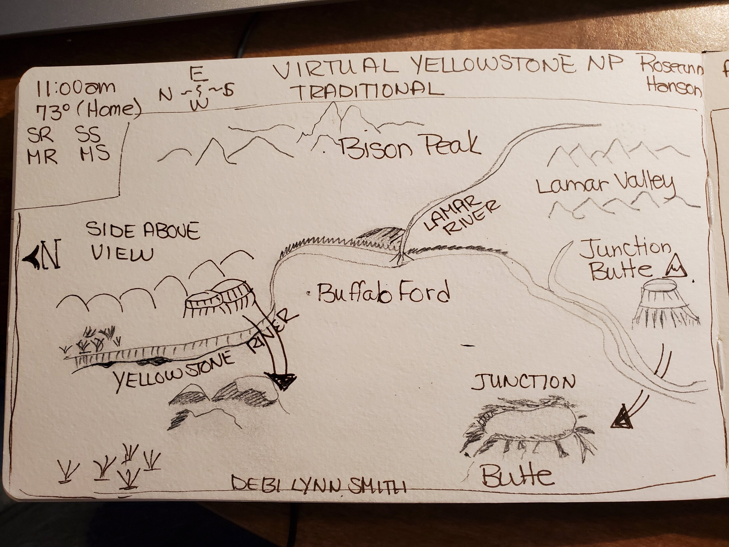
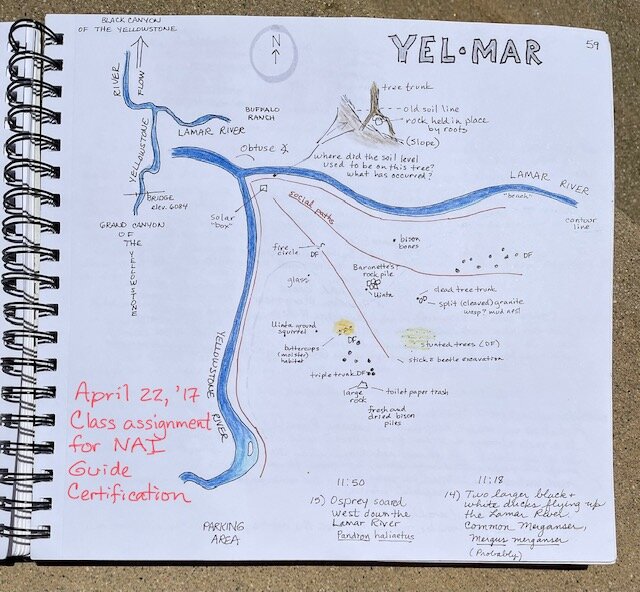
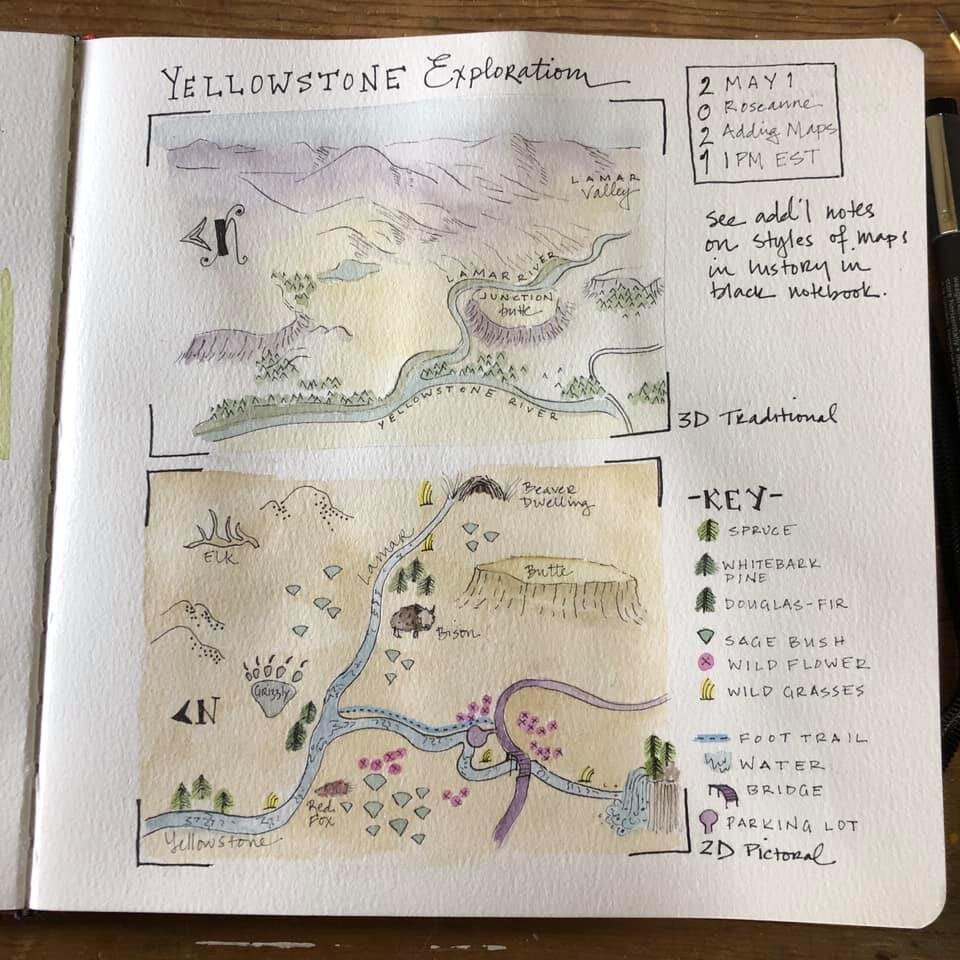
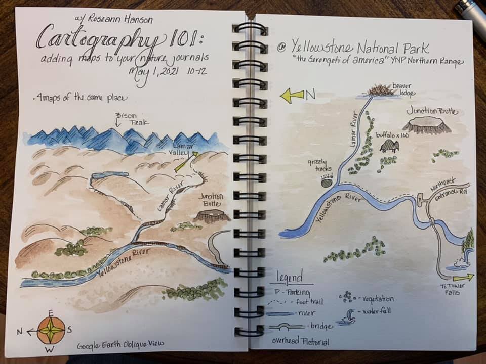
1. Traditional Map - original view

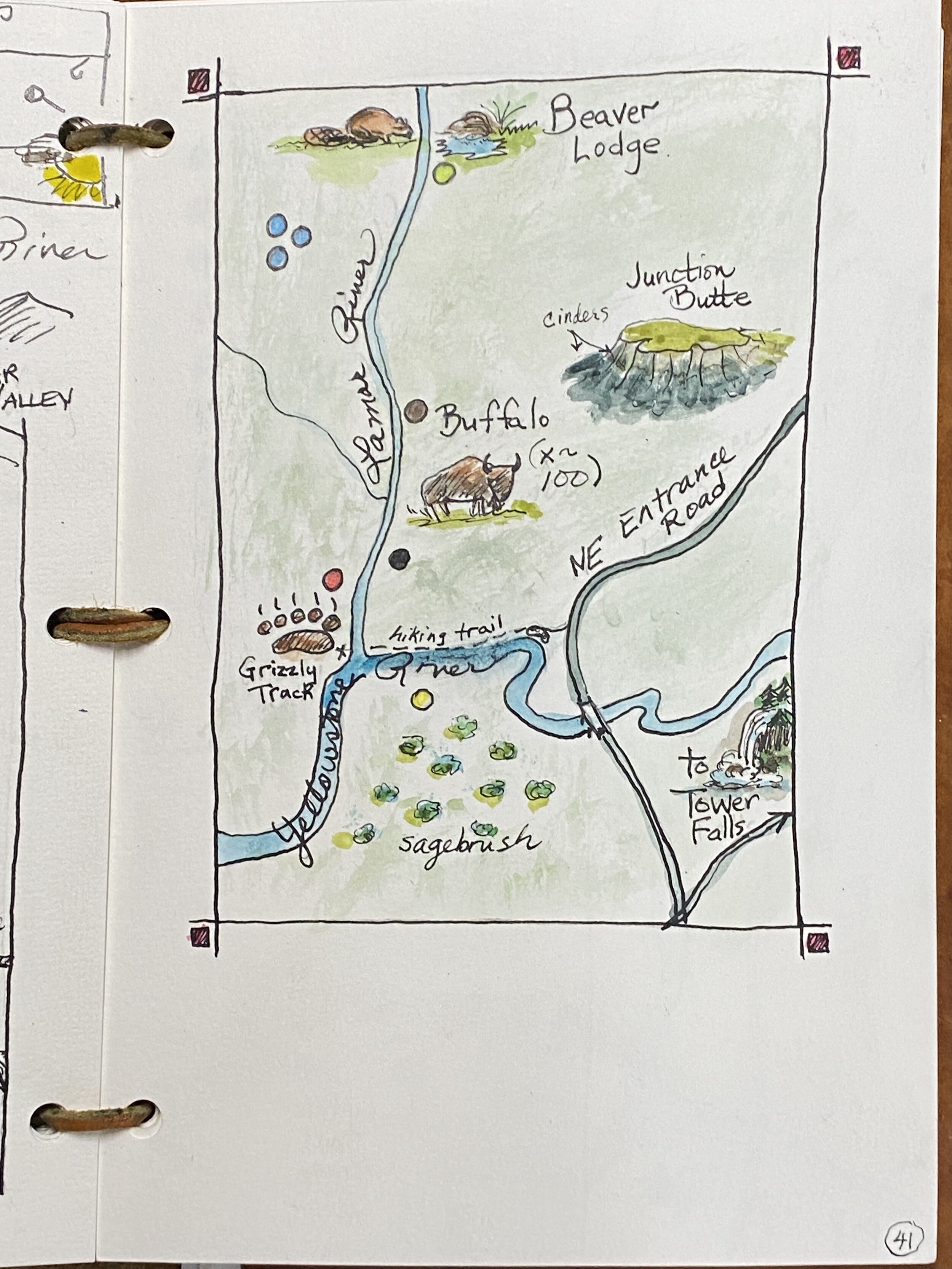
2. Pictorial Map - original view

3. Linear or Strip Map - original view
4. Behavior Map - original view